The 80-canal, 180-mile drainage grid that made Palm Bay buildable
Palm Bay sits on 40,000 acres of land that was, in 1922, mostly seasonal wetland. A drainage district started cutting canals that year; General Development Corporation expanded the system through the 1960s. The result is roughly 180 miles of canals discharging into Turkey Creek and the Indian River Lagoon. It worked. It's also poisoning the lagoon.
Palm Bay’s street grid runs over land that, in 1922, was for several months a year underwater. The city is buildable today because of a drainage system that started as a small county effort in the 1920s and that General Development Corporation expanded into roughly 180 miles of canals between 1959 and the late 1970s.
The system works. Palm Bay’s neighborhoods don’t flood except in the worst hurricane years. The system also drains directly into Turkey Creek and the Indian River Lagoon, and that discharge is one of the principal sources of nutrient pollution killing the lagoon’s seagrass and oyster habitats.
The 1922 starting point
Florida’s drainage history runs back to the Everglades drainage projects of the 1910s. The state established drainage districts as a legal mechanism to assess property owners for canal construction. Brevard County’s first drainage district covering the Palm Bay area was organized in 1922.
The early 1920s effort was modest. Local landowners, mostly citrus growers and cattle ranchers, needed seasonal drainage of their lower-elevation parcels. The 1922 system was probably less than 30 miles of canals total, cut by mule-drawn equipment, designed for agricultural rather than residential use.
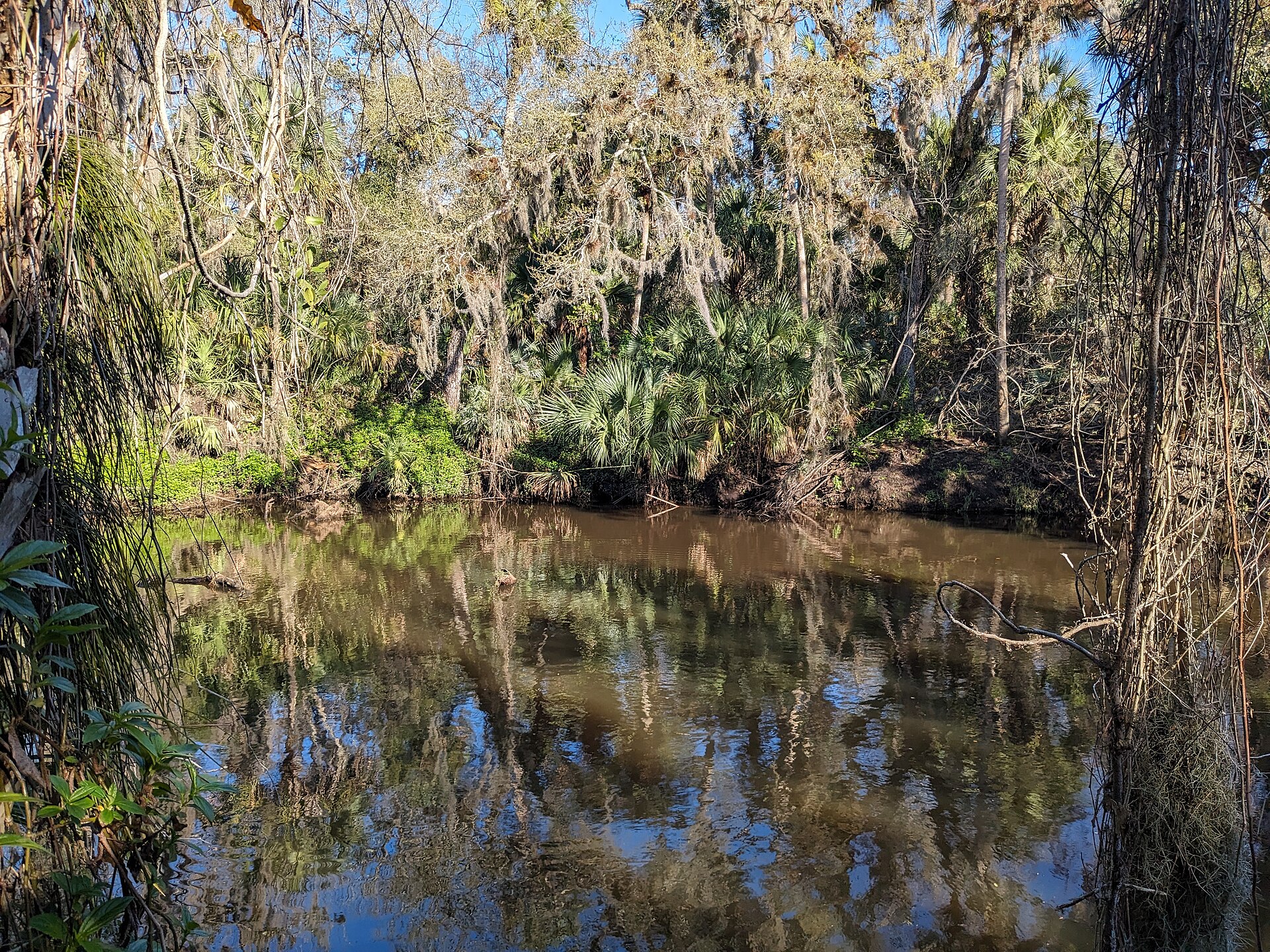
That foundational system established the basin geometry: canals running roughly east, discharging into Turkey Creek and from there into the Indian River Lagoon. Subsequent expansions kept the same downstream orientation. There was, and is, no significant westward discharge alternative; the elevation drops east toward the coast.
The GDC build-out
When General Development bought the Palm Bay tract in 1959, the existing 1920s canal system covered only a fraction of the 41,000 acres GDC planned to plat. To make the rest buildable, GDC had to dewater seasonally-wet parcels across the western portion of the tract.
The company contracted with private engineering firms and worked with the drainage district to expand the canal grid systematically. Between 1959 and approximately 1975, the canal system grew from the 1920s baseline to roughly 180 miles in total length. The number 80, as in “80 canals,” refers to numbered canals in the formal drainage system; the system also includes hundreds of smaller ditches feeding the numbered canals.
The post-GDC canal system covers approximately 40,000 acres of drained area. Most of Palm Bay’s western and southwestern footprint sits on this drained ground. The arterial street grid largely parallels canal alignments; canals are usually visible adjacent to major roads, often as concrete-lined or grassed-bank channels running between parallel rows of houses.
What the system does, mechanically
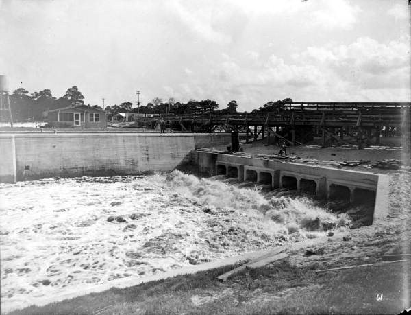
The grid functions as a gravity-fed surface water collection and discharge system. Rainwater falls on the relatively flat terrain of Palm Bay’s western neighborhoods. Surface runoff flows into ditches that feed canals. The canals carry water east, eventually discharging through control structures into Turkey Creek and, downstream of Turkey Creek, into the Indian River Lagoon.
Control structures (weirs, locks, pumps in some segments) maintain canal water levels to keep groundwater tables low enough that residential foundations stay above water year-round. During dry seasons, water levels are held higher to reduce saltwater intrusion from the lagoon. During wet seasons, particularly during tropical storms and hurricanes, the system releases water aggressively to prevent residential flooding.
Total discharge from the Palm Bay drainage system into Turkey Creek is significant on an annual basis. USGS gaging at the lower reaches of Turkey Creek records the combined output. During major rain events, discharge can spike from baseline flows of tens of cubic feet per second to thousands.
What gets carried downstream
Surface runoff in a developed residential area picks up nutrient and contaminant loads from a predictable list of sources: lawn fertilizer, septic system effluent (where municipal sewers don’t reach), pet waste, automotive fluids, atmospheric deposition. Most of Palm Bay’s drainage area is on septic, not municipal sewer, which makes the nitrogen load from residential drainage particularly high.
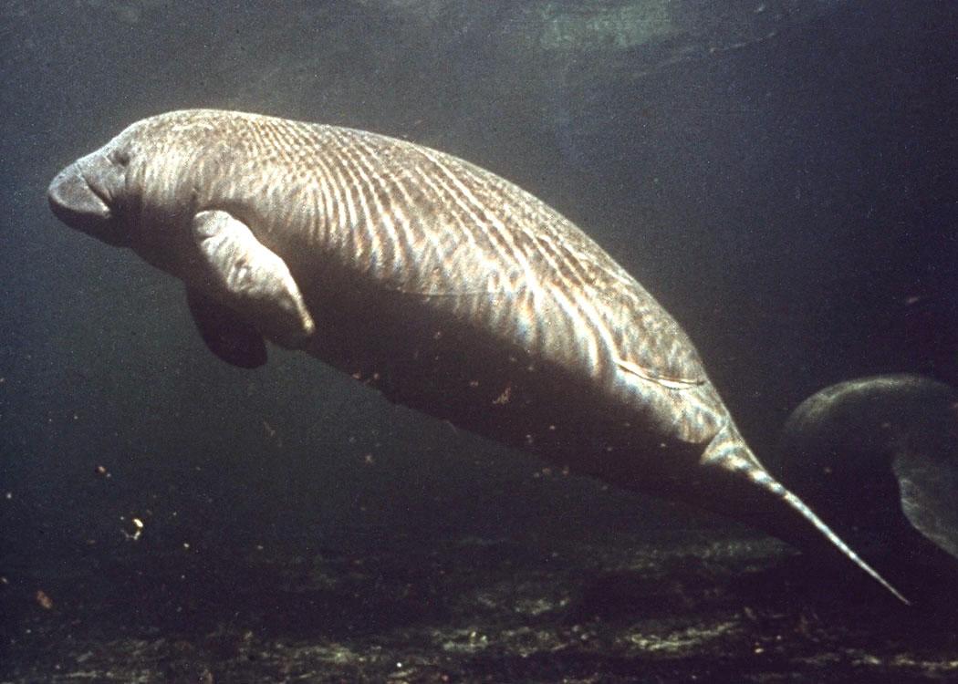
Nitrogen and phosphorus are the proximate cause of the Indian River Lagoon’s water quality collapse. Excess nutrients drive algal blooms; the algal blooms shade out seagrass; the seagrass loss eliminates the foundational habitat for the lagoon’s fish and shellfish populations. The lagoon has lost an estimated 50,000+ acres of seagrass since 2009.
Palm Bay’s drainage system is not the only source of the lagoon’s nutrient problem. The St. Johns River, the entire developed coastline, agricultural runoff from inland Brevard and Indian River counties, atmospheric deposition from far-distant sources, all contribute. But Palm Bay’s drainage is significant. The Indian River Lagoon Council’s source-tracking work identifies Turkey Creek discharge as one of the major nutrient pulses entering the southern lagoon.
Restoration tradeoffs
The fundamental tension is that Palm Bay can’t function as a city without the drainage system. Disabling or significantly reducing canal capacity would re-flood thousands of acres of platted neighborhoods, render houses unbuildable, and produce a regional civil emergency that no level of government will allow.
What can be done is to filter the discharge before it reaches the lagoon. Various stormwater treatment areas, retention ponds, and biofilter projects have been built in the Turkey Creek watershed over the last two decades. The St. Johns River Water Management District funds and manages some of these. The City of Palm Bay maintains others. Brevard County’s voter-approved Save Our Indian River Lagoon sales tax, passed in 2016, funds additional projects, including septic-to-sewer conversions in the city that should reduce the nitrogen load over time.
The restoration projects help on the margin. They don’t reverse the underlying problem, which is that 40,000 acres of drained former wetland produces residential runoff that hits the lagoon through a 180-mile delivery system optimized for fast removal.
What the alternative would have looked like
It’s worth being clear about what would have happened if the 1920s drainage district had never organized or if GDC had built differently. The 40,000 acres in question would have remained mostly seasonal wetland. They would have absorbed nutrient loads from upstream agricultural activity rather than passing them through. The Indian River Lagoon would have received less direct anthropogenic nitrogen and phosphorus through this watershed. Seagrass coverage would probably be significantly higher than it is today.
The city of Palm Bay, in that alternative, would also not exist as it does now. 120,000 people live on the drained land. The economic value of the residential development built on the GDC plat is in the tens of billions of dollars. None of that exists without the canals.
This is not a sentimental tradeoff. It’s the actual structural reality of the city. Palm Bay was built by draining a wetland. The drained wetland’s downstream legacy is the lagoon’s nutrient problem. The two facts are inseparable. Anyone who proposes restoring the lagoon by removing the city’s drainage system isn’t proposing restoration; they’re proposing depopulation.
The number 80 and the number 180
The “80 canals, 180 miles” formulation comes from the drainage district’s own numbering convention. Each major canal in the system is numbered. The system has approximately 80 numbered canals. Their combined length is approximately 180 miles. The numbering is functional, not historical: the canals were not built in numerical sequence and the number doesn’t tell you which canals are oldest.
The oldest segments, the original 1920s canals, are clustered in the eastern portion of the system, closer to Turkey Creek and the lagoon. The newer segments, the 1960s-1970s GDC build-out, run west across what’s now mostly residential Palm Bay.
The numbers are easy to look up. The hydrological consequences they describe are harder to undo.
Further Reading
As an Amazon Associate we earn from qualifying purchases.