The Indian River Lagoon at Palm Bay
The Indian River Lagoon forms Palm Bay's eastern boundary. It's one of the most biodiverse estuaries in North America. It's also dying, slowly, from nutrient pollution that the Palm Bay drainage system contributes to substantially. The lagoon's condition is the city's most consequential long-term environmental story.
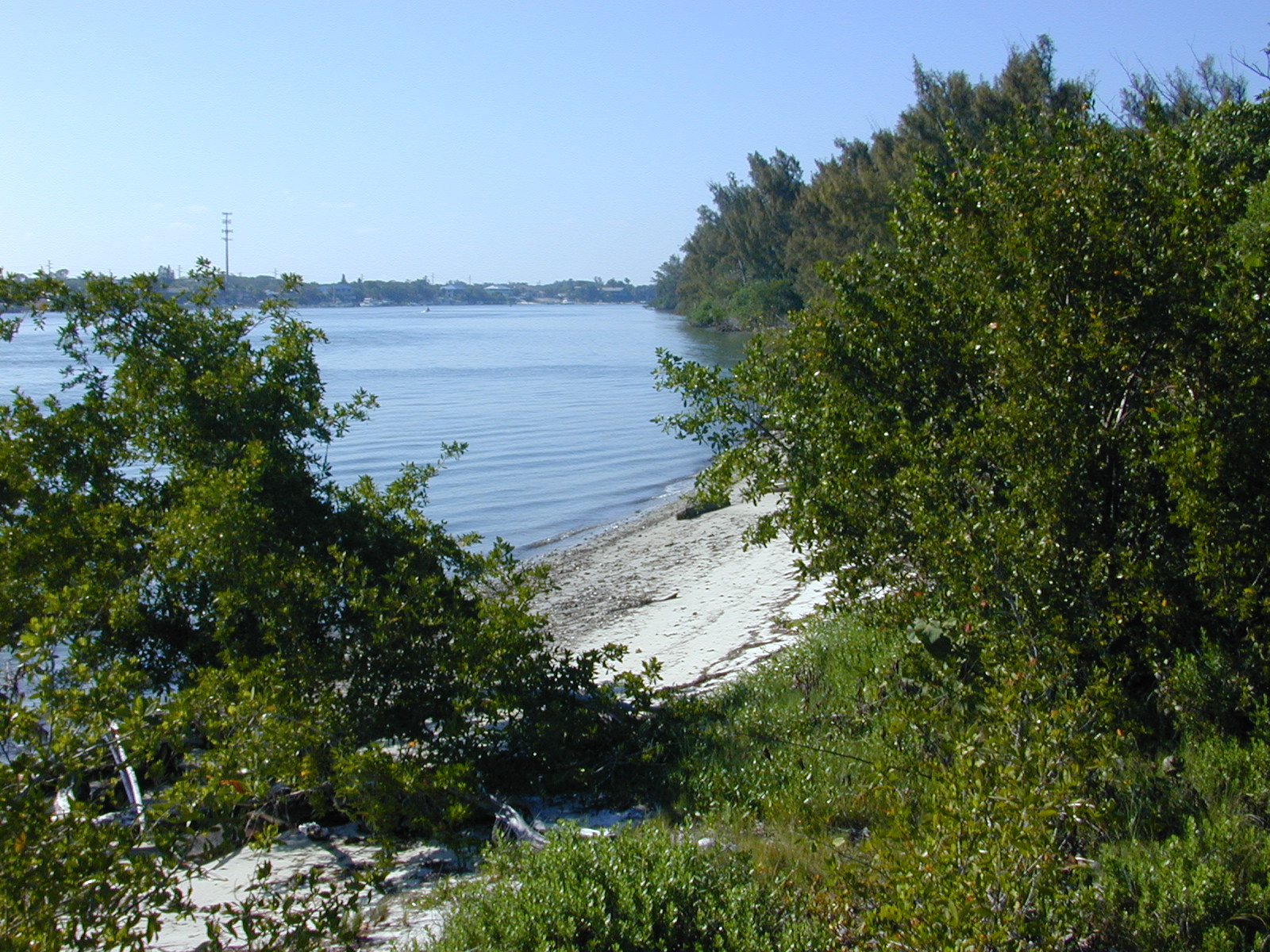
The Indian River Lagoon is 156 miles long, stretches along Florida’s east-central coast from Ponce de Leon Inlet to Jupiter Inlet, and constitutes the eastern edge of Palm Bay. The lagoon supports more than 4,300 documented species of plants and animals, including 35 species classified as rare, threatened, or endangered. It is considered one of the most biodiverse estuaries in North America.
It is also, by every measurable indicator, in serious ecological decline. Seagrass coverage has collapsed by more than 50% since 2009. Algal blooms have intensified and persisted. Manatee mortality has surged. Fish and shellfish populations have declined. The condition is sufficiently bad that the State of Florida, federal agencies, and county governments are spending hundreds of millions of dollars on restoration efforts that are, at best, slowing the decline rather than reversing it.
What the lagoon is, structurally
The Indian River Lagoon is not a river. It’s a shallow, mostly brackish lagoon separated from the Atlantic Ocean by a barrier island chain. Water exchanges with the ocean through a small number of inlets, principally Ponce de Leon, Sebastian, Fort Pierce, and St. Lucie inlets. The exchange is limited; lagoon water turns over slowly compared to true tidal estuaries with broader ocean connections.
Average lagoon depth is 4-6 feet across most of its length. Bottom substrate ranges from mud and silt in lower-energy areas to sand and shell hash in higher-energy areas. Pre-decline seagrass coverage extended across most of the lagoon’s shallow areas; current coverage is patchy and reduced.
The lagoon’s biology is dominated by seagrass beds (Halodule wrightii, Syringodium filiforme, Thalassia testudinum and others), oyster reefs, mangrove communities along the shore, and the open-water column with its fish, shellfish, and plankton populations. Wading birds, sea turtles, dolphins, and manatees use the lagoon for various life functions.
Why nutrient pollution matters
The lagoon’s collapse since the 1990s has been driven primarily by excess nitrogen and phosphorus, the same nutrient pollutants that drive eutrophication in freshwater lakes and ocean dead zones. Excess nutrients drive algal blooms; the blooms shade out seagrass; seagrass loss eliminates the foundational habitat for the lagoon’s food web; fish, shellfish, and wildlife populations decline as their habitat support disappears.
The 2011 “superbloom,” a massive algal event that covered much of the lagoon’s northern reach including the Palm Bay area, killed approximately 47,000 acres of seagrass in a few months. Subsequent algal events have continued the loss. Current seagrass coverage is approximately half of the historical baseline.
The nutrient sources have been catalogued in detail. They include atmospheric deposition (nitrogen from distant fossil fuel combustion), agricultural runoff (citrus, vegetable operations, cattle pasture), residential runoff (lawn fertilizer, septic tank effluent, pet waste), wastewater treatment plant discharge, and industrial sources. The relative contribution of each source varies by location and by year, but residential runoff and septic effluent are major contributors in the Palm Bay-influenced southern lagoon.
Palm Bay’s specific contribution
Palm Bay’s drainage system feeds Turkey Creek, which discharges directly into the Indian River Lagoon. The drainage area covered by the city’s canal system is approximately 40,000 acres, with substantial residential development including a large share of homes on septic systems rather than municipal sewer.
The nitrogen load from Palm Bay’s drainage area is measurable and substantial. IRL Council source-tracking work identifies Turkey Creek discharge as one of the principal nutrient inputs to the southern lagoon. The specific contribution of Palm Bay’s residential and infrastructure runoff to the lagoon’s total nutrient load is a non-trivial percentage of the total southern-lagoon nutrient flow.
This is uncomfortable framing for a city that’s part of the lagoon-restoration effort. Palm Bay’s officials, residents, and businesses are largely committed to reducing the city’s contribution to the lagoon’s nutrient problem. But the structural reality is that 120,000 people on drained land, mostly on septic, can’t avoid producing substantial nutrient discharge unless the city undertakes significant and expensive infrastructure changes.
Restoration efforts in the Palm Bay area
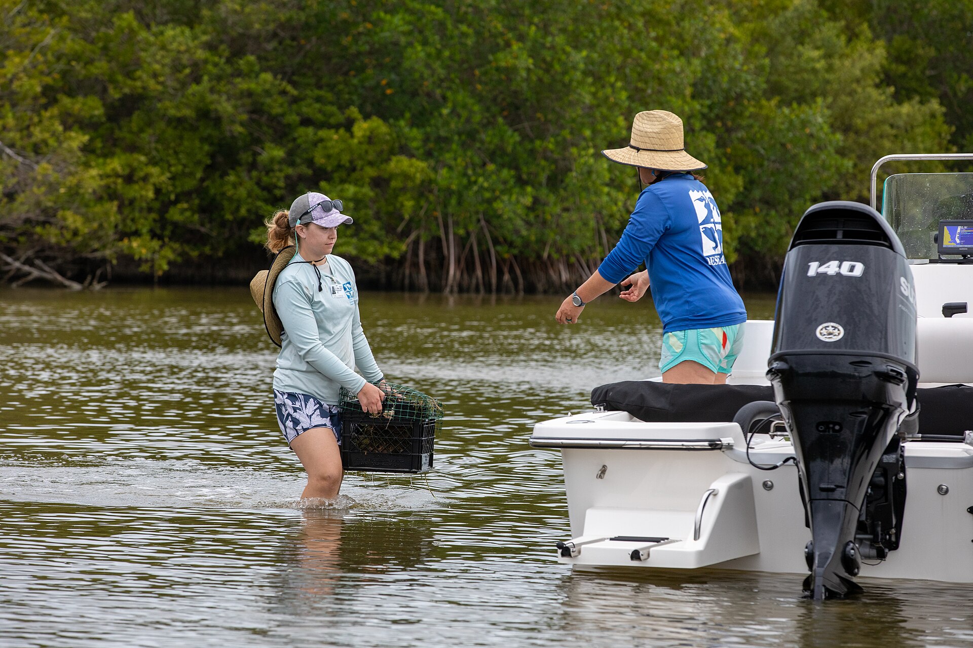
Brevard County’s Save Our Indian River Lagoon program, funded by a voter-approved half-cent sales tax passed in 2016, allocates significant funds to lagoon restoration projects. Palm Bay-area projects include septic-to-sewer conversion in selected neighborhoods, stormwater treatment facility construction, oyster reef restoration in Turkey Creek and along the lagoon shoreline, and various smaller water-quality improvements.
Septic-to-sewer conversion is the highest-impact individual category. Each Palm Bay home converted from septic to municipal sewer removes a continuous nitrogen point source from the drainage area. The math is unambiguous: septic systems leak nitrogen into the soil and groundwater at rates roughly an order of magnitude higher than well-functioning municipal sewer collection. Replacing thousands of Palm Bay septic systems with sewer connections would meaningfully reduce the city’s nitrogen contribution to the lagoon.
The pace of conversion is constrained by cost. The Brevard County program funds conversions on a project-by-project basis; each conversion involves both new sewer line construction (paid largely by the program) and connection costs for individual homeowners (paid by various combinations of homeowner contribution, special assessment, and program subsidy). Palm Bay’s septic-to-sewer conversion has been ongoing for years; many more years and probably another generation of funding will be required to complete the city’s transition.
The manatee dimension
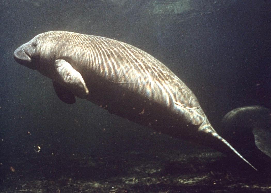
Manatees are the most visible indicator of the lagoon’s decline. The species’ population is closely tied to seagrass availability, since seagrass is the primary food source for the lagoon manatee population. Seagrass loss has driven manatee malnutrition, which has driven manatee mortality.
The 2020-2022 “unusual mortality event” recorded approximately 1,800 manatee deaths in Florida, with the largest single concentration in the Indian River Lagoon. The cause was determined to be starvation from seagrass loss. The mortality event has been declared “ongoing” by federal wildlife regulators, meaning conditions remain insufficient to support the historical manatee population.
Palm Bay’s Turkey Creek Sanctuary provides one of the few remaining warm-water refuges that manatees use in winter. The Sanctuary’s manatee presence has been observed at higher numbers in recent winters than historically, possibly because alternative refuges in the lagoon are themselves stressed. The Sanctuary is not, however, equipped to provide food (seagrass) in addition to warm water; manatees using the Sanctuary in winter must forage in degraded seagrass habitats during the day.
The manatees are, in a real sense, the canary in the lagoon coal mine. Their condition tracks the lagoon’s overall condition with precision. The current manatee situation is poor. The lagoon’s situation is correspondingly poor.
What the long arc looks like
The Indian River Lagoon’s pre-development condition, the condition the Ais people knew and that 19th-century settlers found, was one of the most productive estuaries on the Atlantic seaboard. Seagrass beds covered the shallows. Oyster reefs lined the shorelines. Manatees, sea turtles, dolphins, and various fish species supported sustained subsistence and commercial fisheries.
The lagoon’s degradation began in the late 19th and early 20th centuries with shoreline modifications, dredging, and the beginning of industrial-scale citrus and vegetable production in the watershed. The pace of degradation accelerated through the 1950s and 1960s as Florida’s east-coast population grew. The catastrophic phase of the decline, the 2009-onward collapse of seagrass beds and the associated wildlife population crashes, is recent and ongoing.
The lagoon’s restoration trajectory, if current efforts succeed at the scale being attempted, is gradual recovery over decades. Reducing nitrogen and phosphorus inputs to the lagoon allows water clarity to improve, allows seagrass to recover, allows the food web to rebuild. The timeline is measured in generations, not years.
If current restoration efforts fail to keep pace with continued degradation, or if climate-driven impacts (warming water, increased storm intensity, sea-level rise affecting circulation) outpace the restoration, the lagoon’s biological collapse continues. The result would be a lagoon dominated by algae, lacking seagrass and most of its current wildlife, providing reduced ecosystem services to surrounding communities including Palm Bay.
The civic question
Palm Bay’s relationship to the Indian River Lagoon is, structurally, contradictory. The city was built by draining land that fed the lagoon’s nutrient supply naturally. The city’s residential runoff and septic effluent contribute to the lagoon’s degradation. The city benefits from the lagoon’s continuing existence as a property-value, recreational, and environmental amenity. The city’s restoration contribution, septic-to-sewer conversion, stormwater treatment, public education, is real but constrained by cost.
This is not a problem with a clean solution. Palm Bay cannot un-build itself. The drainage system cannot be removed. The septic-to-sewer conversion will take generations to complete. The lagoon’s recovery, if it happens, will take longer than the restoration funding cycles that are currently funding it.
What the city can do, and what the city has committed to doing through county-level action, is continue the long incremental restoration work. Reduce the nutrient load by the achievable margin. Protect the remaining seagrass. Support the manatee refuge functions of Turkey Creek Sanctuary. Hope that the lagoon’s collapse can be slowed enough that future restoration efforts can build on a foundation that hasn’t entirely disappeared.
That’s the honest assessment. The lagoon may be saved. It may not be. The city’s actions matter and probably don’t matter enough. The next decade will tell.
Further Reading
As an Amazon Associate we earn from qualifying purchases.